It's been ten great days since my plane burst out from cloud above the Beagle Channel and I caught my first glimpse of Tierra del Fuego. The initial view was impressive - tree cloaked hills rose from the clear blue sea up to majestic jagged peaks, the tops of which were covered in snow and glaciers. The landscape was reminiscent of the west coast of Scotland - not the barren and windswept land I had imagined.
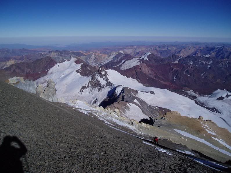
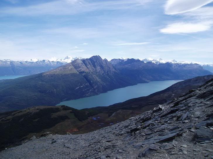
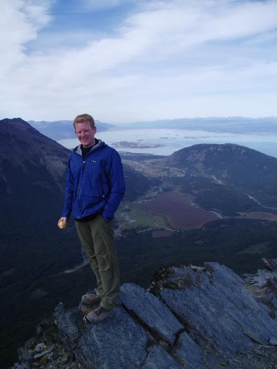
The view from Cerro Guanaco, Tierra del Fuego NP, looking over Ushuaia and The Beagle Channel
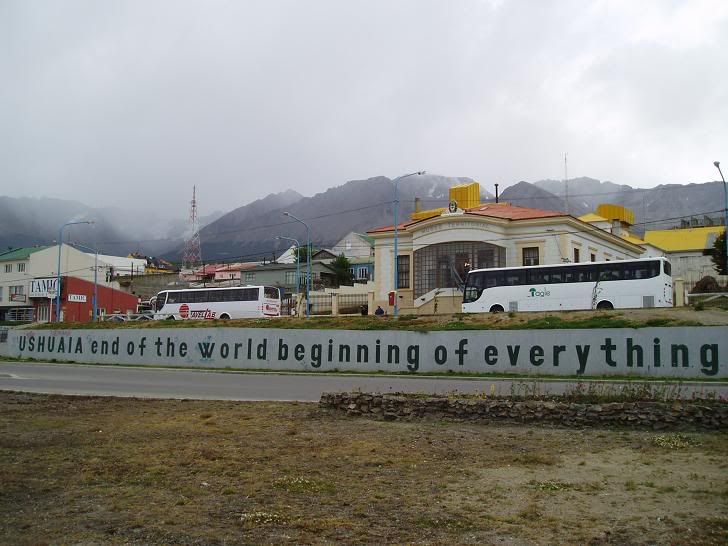
Ushuaia sits on the edge of the Beagle Channel, trapped between mountains to the north and the sea to the south. It is a young city, first populated in the 1800s, with a diverse mix of early settler cabins juxtaposed with modern concrete housing and industry. The climate also has a Scottish feel - cool, a lot of rain, sunny spells but thankfully no midges. It has the pride of being the southernmost city in the world, and hence is the jumping off point for a good proportion of trips to the Antarctic. It is also the capital of the Argentine province of Tierra del Fuego, which includes the claims on Islas Malvinas (The Falklands) and South Georgia. As such, whilst being very welcoming to tourists, there is a reserved attitude to the British - the 1982/3 war was fought from here and memories don't fade that quickly.
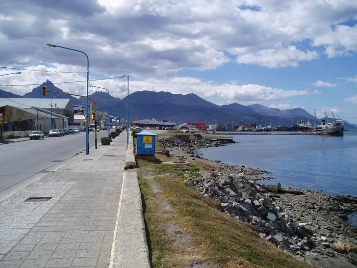
The view from the seafront back over town
Tierra del Fuego lies at the southerly end of South America, divided between Chile and Argentina and separated from the mainland by the Straits of Magellan. Here the Andes rotate from their normal north-south axis to reach their end running west-east, losing height from icecapped mountains in the west to smaller hills in the east.
Looking back to the Andes from above Ushuaia
I feel I should mention the hostel I am staying in, as I have been here 11 nights and have yet to go out for an evening. The hostel is new, friendly and very well run; there's a 24 hour bar, good music and great people. It has yet to make it into the guide books but is full every night after only 9 months of opening - that speaks for itself. Perhaps the only downside is the high Israeli content of the hostel.
A lot of Israelis tend to go travelling around the world after their 2 or 3 years in the army, aged 21 or 22. The majority have a tendency to travel in groups that are often rather insular and very loud. I have yet to meet an Israeli who I do not like on an individual basis, but the reputation of the travelling groups does a lot of damage to their reputation amongst other backpackers.
The view along the seafront
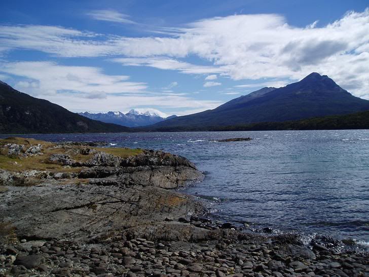
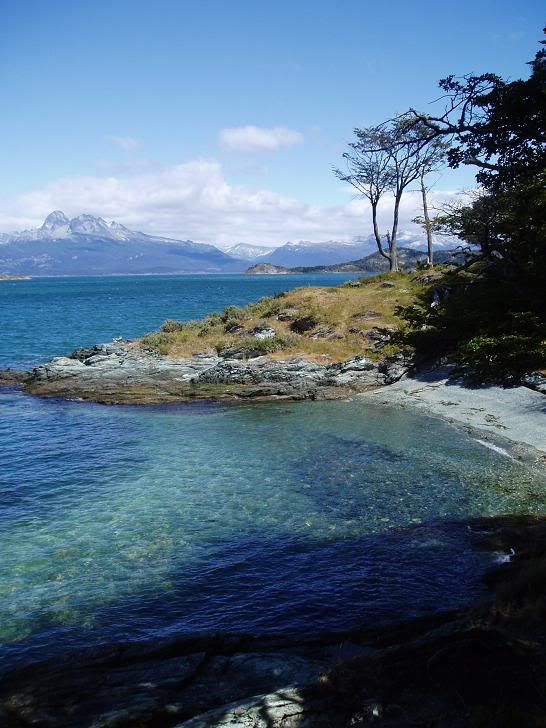
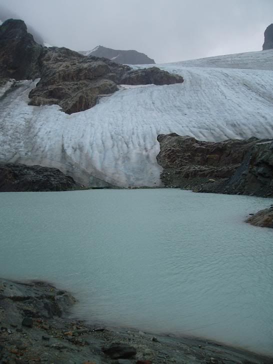
10 days is a long time to spend in Ushuaia for most people. There are excursions to the Tierra del Fuego National Park to climb the Cerro Guanaco, the local viewpoint mountain, plus amble along the lovely coastline. There are plenty of guided treks to do to different glaciers, ice caves and old homesteads. The first couple of days I spent in the National Park / the views from Cerro Guanaco are above.
Views across The Beagle Channel to Chile
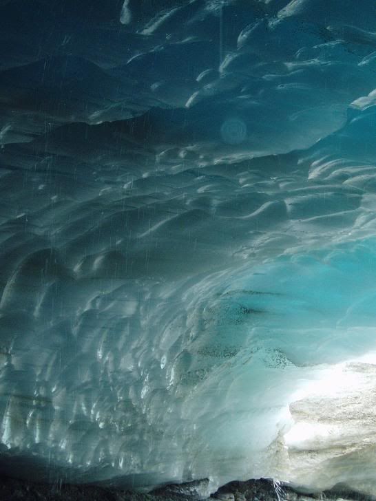
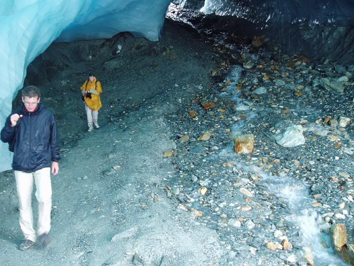
I also paid (probably too much money) to visit a huge ice cave underneath a glacier. We climbed for a couple of hours in atrocious weather to what was very much an anticlimax - the brochure photos were, of course, much better.
Below the ice cave
In the ice cave
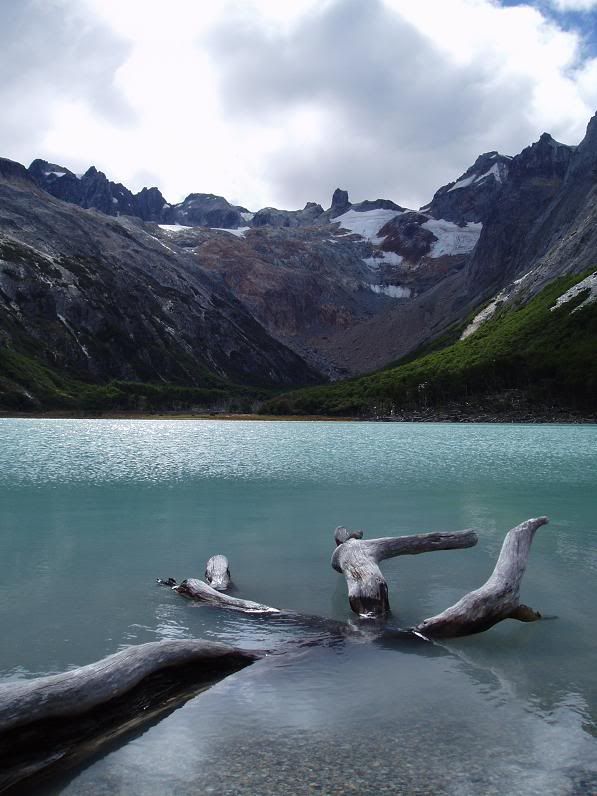
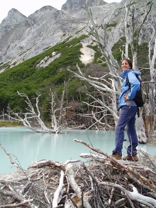
Probably the best trip so far has been to the lovely Laguna Esmerelda, a glacial lake sitting in a beautiful alpine valley. One of the most striking things on the visit was seeing the destruction that beavers in the area are wreaking; there are numerous beaver dams and incredible numbers of felled trees, some of them surprisingly large.
Laguna Esmerelda
Angie (friendly American girl!)on a beaver dam above the Laguna
The question people may be wondering is why have I spent so long in Ushuaia. The reason is simple - I am waiting for a boat to leave for Antarctica. I have booked myself on board for a 10 day cruise starting the 1st of March. After 2 days of crossing the notorious Drake Passage we will reach the white continent, where hopefully we will be able to land several times and explore a little.
I can't wait.... I'll let you know how it was.
Monday, February 28, 2005
Wednesday, February 16, 2005
Aconcagua Part 3 – The Summit Attempt
The 8th dawned bright, clear and cold. The walk up to Nido de Condores is about 7-8 hours in total – at that altitude everything take a lot longer than would do in, for example, the Scottish hills. We left at 10.30am, and arrived at around 5pm. Sadly Paco had been unable to adjust to the altitude sufficiently quickly and was not allowed to come with us as we set off – he headed back to Mendoza to enjoy the sunshine, warmth and beer.
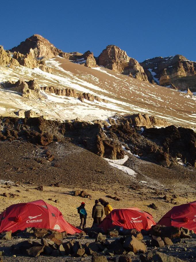
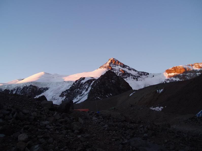
Evening sun in Nido, Aconcagua in background
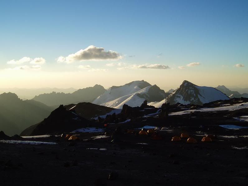
Evening, looking over the rest of Nido
The walk was noticeably easier than the first porterage up to Nido, but I still arrived with a slight headache and nausea. In these situations, the nausea usually passes after 1-2 hours, and the best thing to do is to eat and drink as much as you can stomach.
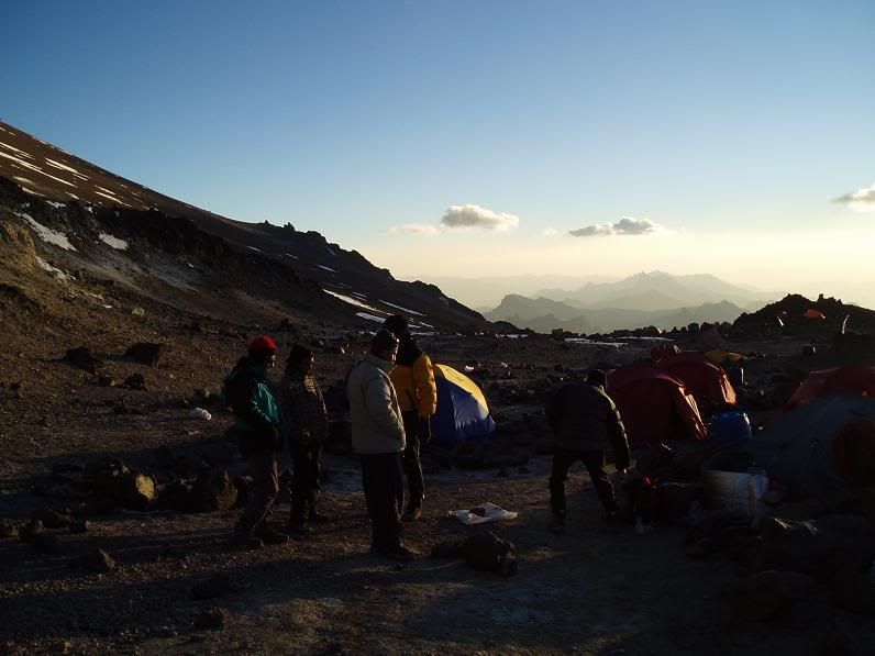
The camp set-up
Once at Nido we set up several more tents so that in total we were 2 per tent. There is a total lack of running water at Nido so snow has to be taken from patches that lie round about and melted. Melting snow is a slow process, both in terms of speed at which it melts and quantity of snow required to produce enough water for 15 people (11 clients and 4 guides).
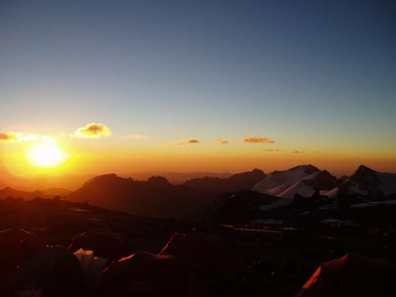
Sunset at Nido - 1
Food options at Nido were a lot more limited than at Plaza de Mulas – main meals were either rice or pasta based with sauce, followed by lots of high calorie snack options.
Before dinner the group had a discussion on the best way to attempt the summit. There are basically two ways to do the “normal” route – the first is 2 walk all the way from Nido to the summit and back again in a day; a total of about 17 hours and total height gain of around 1700m. That is a very big walk at any altitude, and there was some resistance against the idea. The second option was to spend the next day walking to Berlin, a cluster of 3 small huts and area flat enough to pitch tents, at about 5900m. After staying a night at Berlin we could attempt the summit.
Unfortunately Apu, our guide, was probably not as skilled at communicating as he should have been. There was quite a heated argument before it was decided that the group would have a rest day the next day before attempting the summit from Nido.
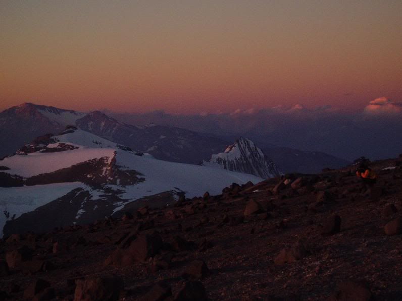
Sunset at Nido - 2
By sundown I had overcome my nausea and was feeling great. Even at Nido we were above the majority of the surrounding mountains and at the sky became dark there were stunning views in all direction. Above us the face of Aconcagua glowed red, whilst to away to the west jagged peaks faded into the distant blue. In the east snow capped mountains reflected pink and orange, and the sight was enough to lift everyone’s spirits.
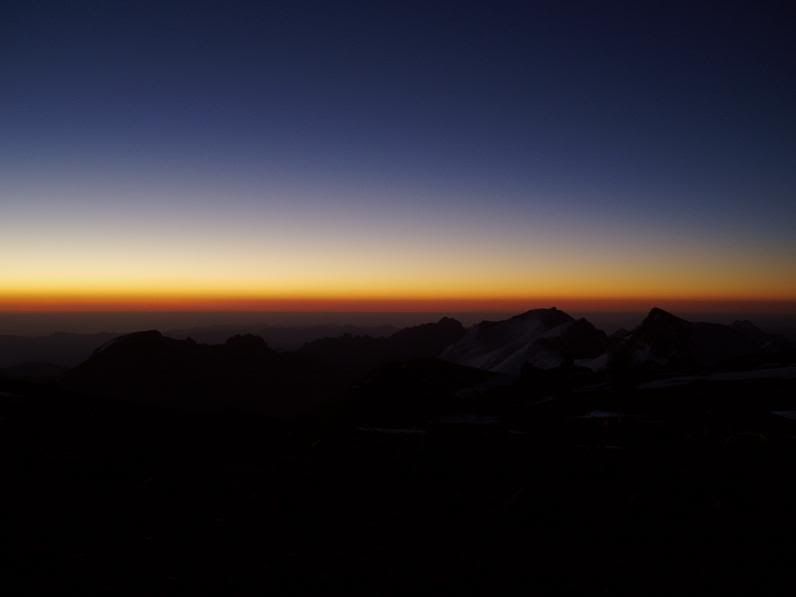
Nightfall at Nido
The next morning I woke with my now almost constant head and neck ache, which I blamed on both carrying a fairly heavy rucksack the day before and the altitude. As usual, it improved fairly rapidly with ibuprofen and more sleep. The rest day was exactly that – eat, sleep, drink (lots!), plus some interminable discussions in Spanish as to the pros and cons of heading for the summit straight from Nido, rather than going to Berlin first. I was happy to do as Apu suggested – he was after all a professional mountain guide – but I could see that his manner left something to be desired. I put this down to his relative inexperience with large groups and age – he was only my age and dealing with experienced walkers twice his age.
We all turned in early for the 3am start for the summit.
We woke the next morning at 2.30am to the sound of howling gusts of wind. After fetching our water out of our sleeping bags (so it didn’t freeze overnight) we ate a heavy breakfast of stodgy cake before venturing outside, wrapped up in layers of thermals, fleeces and windproofs. Outside we were greeted by flurries of horizontal snow and a biting cold.
We set off only 15 minutes late and made very good time to Berlin at 5900m. Almost too good in fact – less than 2 hours instead of the normal 2-4 hours. I had taken a prophylactic ibuprofen already and, at our only rest stop on the way to Berlin, I took an anti-emetic to counter the nausea feelings that were creeping back in – although I wasn’t sure if they were altitude or breakfast related.
At Berlin we stopped for a quick bit of food. A thermometer on the nicest refugio (hut) read -17°C. At this temperature frostbite can become a real problem, and constant movement of fingers and toes is necessary to keep up a good blood flow and prevent it. I was feeling great by now, and was raring to go.
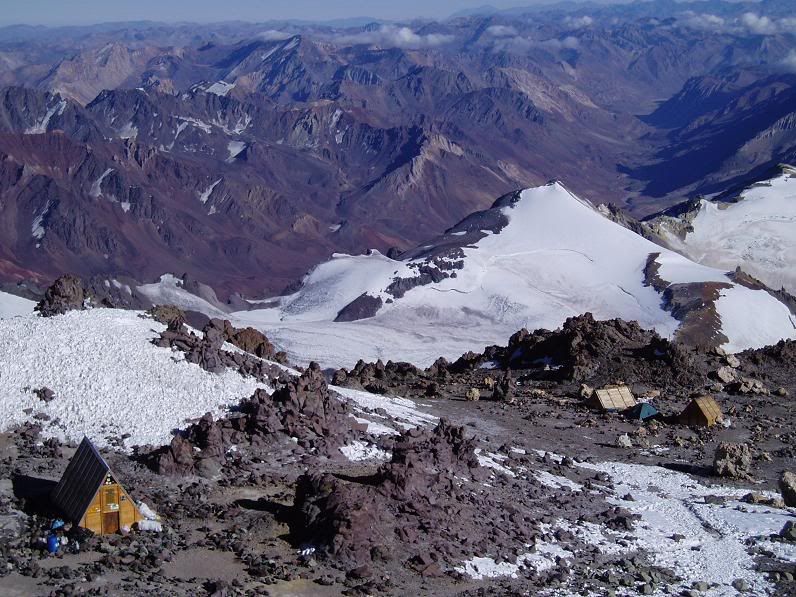
Berlin, taken during my descent
We set off again as a disjointed group. Henrik, Merced, Pepe and Vero turned back due to problems with tiredness, cold or severe headaches. The remaining 7 of us, with 3 guides, pressed on.
At about 6am light appeared on the horizon, and by 7am there was a magnificent sunrise with the shadow of Aconcagua clearly visible on the western horizon.
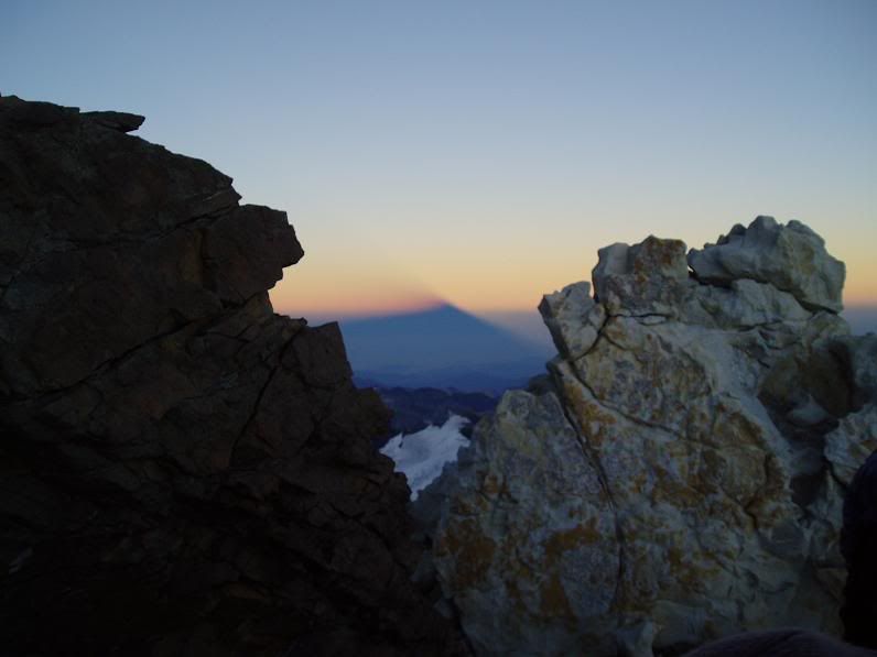
Aconcagua's shadow on the horizon
My earlier good feeling had evaporated and I was now starting to feel the familiar nausea feelings of previous ascensions.
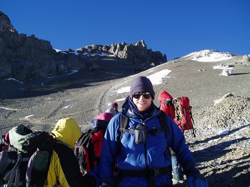
Myself before Independencia, 7a.m.
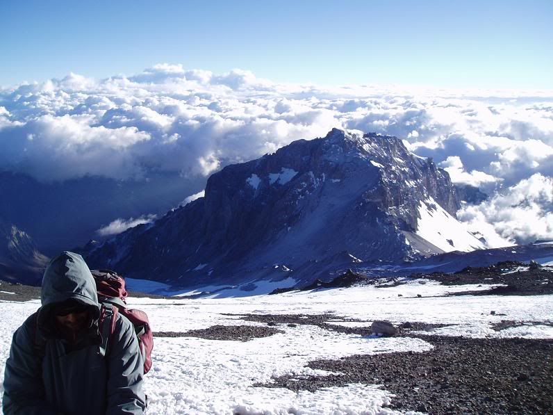
Views from below Independencia
At about 7.30am we reached the euphemistically named Refugio Independencia – an almost derelict tiny hut that has the privilege of being the highest refugio in the world. At 6500m it was still extremely cold, but out of the wind in the sun it was a little more comfortable than the previous hours. It was here that I decided to turn back – the nausea feelings were getting worse and every few steps I though I would throw up.
Going back - Independencia at 7.30am
I was left with strict instructions to back down the way I came (“Keep left! Do not turn off to the right! Keep left!”), and set off down the hill.
The rest of the group (3 guides plus the remaining 6) headed off to the bottom of the La Traversia, a 3 hour, uphill traverse across an exposed and windy scree slope. Beyond that was the dreaded Canaleta, a 2 hour climb up 260m of loose scree, followed by a relatively easy 1 hour walk to the top at 6962m. Relatively easy, note, but at almost 7000m you need to breathe with every single step, and it feels like there are lead weights attached to your feet.
During the descent - above Piedras Blancas and Berlin
I descended much quicker than I had climbed, but still had to stop every few steps to wait for waves of nausea to pass by. It was with some relief that I actually started throwing up when I got to 5700m. After that I felt a little better – both physically and mentally, as I think my body confirmed that I had made the right decision to come down.
I got back to camp at 10.30am or so, just as Anabolico, the guide who had gone down with the 4 others earlier, was setting off to help another member of our group who had fallen ill up the mountain. The Guardaparques had been in radio contact with our group and his help had been requested – little did I realise this help was for me! He climbed up to Independencia quickly and spent a fruitless 2 hours looking for a sick person.
Back at Nido, after about 6 hours sleep I was feeling much better and was able to eat and drink a little. The first of our party came back at 6.30pm – only 15 hours after setting out. The remaining 6 had all summited together at about 1.30pm. The last of our party got back in at 7.30pm, literally on their last legs.
The next day we headed back down to Plaza de Mulas where there was a celebratory lunch arranged for us. We sorted out our gear – the next day we were to walk the 40km out to the park entrance at Horcones, and so we were to send almost everything back by mule to make the journey easier.
After the dinner, back in Plaza de Mulas
The walk-out day started very cold and windy, but almost as soon as we began our descent from Plaza de Mulas it warmed up. After the long days at altitude it became easier to breathe again and vegetation reappeared at about 3500m. In the Andes vegetation ceases about 1500m lower than in the Himalayas, and biologists suspect that the effect of altitude on the body in the Andes is physiologically comparable to being 1500m higher in the Himalayas.
Back on Playa Ancha, Anconcagua in background
The end of the Inferior Horcones Glacier, a black tumbling mass of ice
We headed into La Confluencia briefly for lunch, greeted by the still crazy Matias, before covering the last 10km back to the park entrance in time for a transfer back to Mendoza.
As we walked out the park for the first time we could see all of the south face of Aconcagua, cloud free, rising 4km into the sky. It was as if she was saying her final farewell before we picked up our later transfer back to Mendoza.
Aconcagua's farewell
Finished at Horcones
And next? Well, I'm back in Mendoza enjoying some R&R. On Thursday I fly to Ushuaia in Tierra del Fuego, popularly know as the End of the Earth.
Evening sun in Nido, Aconcagua in background
Evening, looking over the rest of Nido
The walk was noticeably easier than the first porterage up to Nido, but I still arrived with a slight headache and nausea. In these situations, the nausea usually passes after 1-2 hours, and the best thing to do is to eat and drink as much as you can stomach.
The camp set-up
Once at Nido we set up several more tents so that in total we were 2 per tent. There is a total lack of running water at Nido so snow has to be taken from patches that lie round about and melted. Melting snow is a slow process, both in terms of speed at which it melts and quantity of snow required to produce enough water for 15 people (11 clients and 4 guides).
Sunset at Nido - 1
Food options at Nido were a lot more limited than at Plaza de Mulas – main meals were either rice or pasta based with sauce, followed by lots of high calorie snack options.
Before dinner the group had a discussion on the best way to attempt the summit. There are basically two ways to do the “normal” route – the first is 2 walk all the way from Nido to the summit and back again in a day; a total of about 17 hours and total height gain of around 1700m. That is a very big walk at any altitude, and there was some resistance against the idea. The second option was to spend the next day walking to Berlin, a cluster of 3 small huts and area flat enough to pitch tents, at about 5900m. After staying a night at Berlin we could attempt the summit.
Unfortunately Apu, our guide, was probably not as skilled at communicating as he should have been. There was quite a heated argument before it was decided that the group would have a rest day the next day before attempting the summit from Nido.
Sunset at Nido - 2
By sundown I had overcome my nausea and was feeling great. Even at Nido we were above the majority of the surrounding mountains and at the sky became dark there were stunning views in all direction. Above us the face of Aconcagua glowed red, whilst to away to the west jagged peaks faded into the distant blue. In the east snow capped mountains reflected pink and orange, and the sight was enough to lift everyone’s spirits.
Nightfall at Nido
The next morning I woke with my now almost constant head and neck ache, which I blamed on both carrying a fairly heavy rucksack the day before and the altitude. As usual, it improved fairly rapidly with ibuprofen and more sleep. The rest day was exactly that – eat, sleep, drink (lots!), plus some interminable discussions in Spanish as to the pros and cons of heading for the summit straight from Nido, rather than going to Berlin first. I was happy to do as Apu suggested – he was after all a professional mountain guide – but I could see that his manner left something to be desired. I put this down to his relative inexperience with large groups and age – he was only my age and dealing with experienced walkers twice his age.
We all turned in early for the 3am start for the summit.
We woke the next morning at 2.30am to the sound of howling gusts of wind. After fetching our water out of our sleeping bags (so it didn’t freeze overnight) we ate a heavy breakfast of stodgy cake before venturing outside, wrapped up in layers of thermals, fleeces and windproofs. Outside we were greeted by flurries of horizontal snow and a biting cold.
We set off only 15 minutes late and made very good time to Berlin at 5900m. Almost too good in fact – less than 2 hours instead of the normal 2-4 hours. I had taken a prophylactic ibuprofen already and, at our only rest stop on the way to Berlin, I took an anti-emetic to counter the nausea feelings that were creeping back in – although I wasn’t sure if they were altitude or breakfast related.
At Berlin we stopped for a quick bit of food. A thermometer on the nicest refugio (hut) read -17°C. At this temperature frostbite can become a real problem, and constant movement of fingers and toes is necessary to keep up a good blood flow and prevent it. I was feeling great by now, and was raring to go.
Berlin, taken during my descent
We set off again as a disjointed group. Henrik, Merced, Pepe and Vero turned back due to problems with tiredness, cold or severe headaches. The remaining 7 of us, with 3 guides, pressed on.
At about 6am light appeared on the horizon, and by 7am there was a magnificent sunrise with the shadow of Aconcagua clearly visible on the western horizon.
Aconcagua's shadow on the horizon
My earlier good feeling had evaporated and I was now starting to feel the familiar nausea feelings of previous ascensions.
Myself before Independencia, 7a.m.
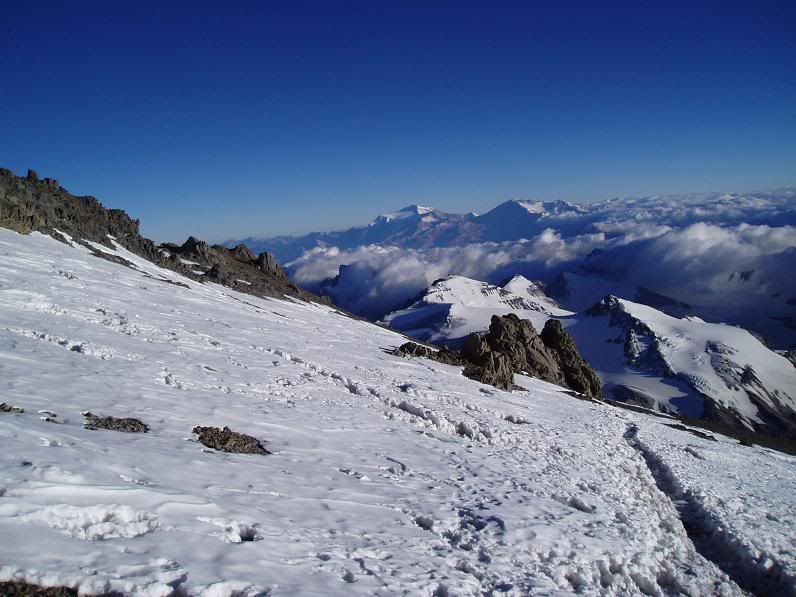
Views from below Independencia
At about 7.30am we reached the euphemistically named Refugio Independencia – an almost derelict tiny hut that has the privilege of being the highest refugio in the world. At 6500m it was still extremely cold, but out of the wind in the sun it was a little more comfortable than the previous hours. It was here that I decided to turn back – the nausea feelings were getting worse and every few steps I though I would throw up.
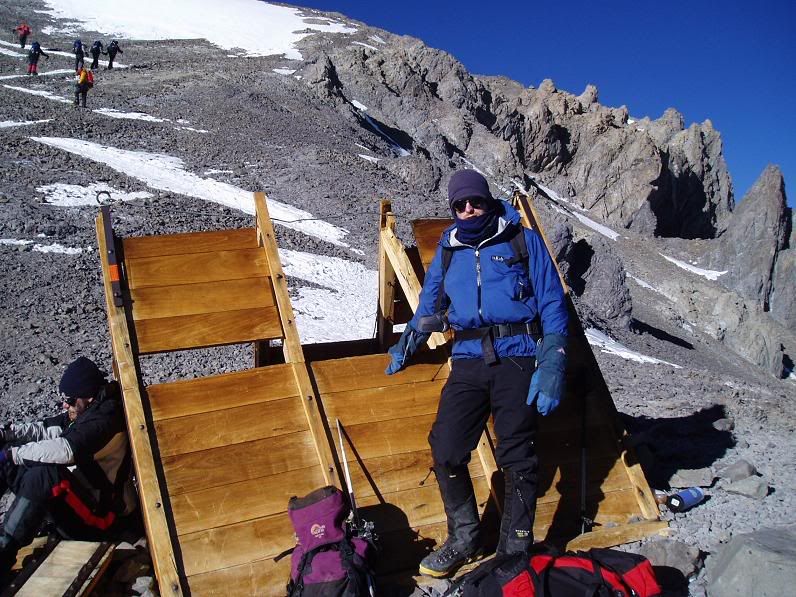
Going back - Independencia at 7.30am
I was left with strict instructions to back down the way I came (“Keep left! Do not turn off to the right! Keep left!”), and set off down the hill.
The rest of the group (3 guides plus the remaining 6) headed off to the bottom of the La Traversia, a 3 hour, uphill traverse across an exposed and windy scree slope. Beyond that was the dreaded Canaleta, a 2 hour climb up 260m of loose scree, followed by a relatively easy 1 hour walk to the top at 6962m. Relatively easy, note, but at almost 7000m you need to breathe with every single step, and it feels like there are lead weights attached to your feet.
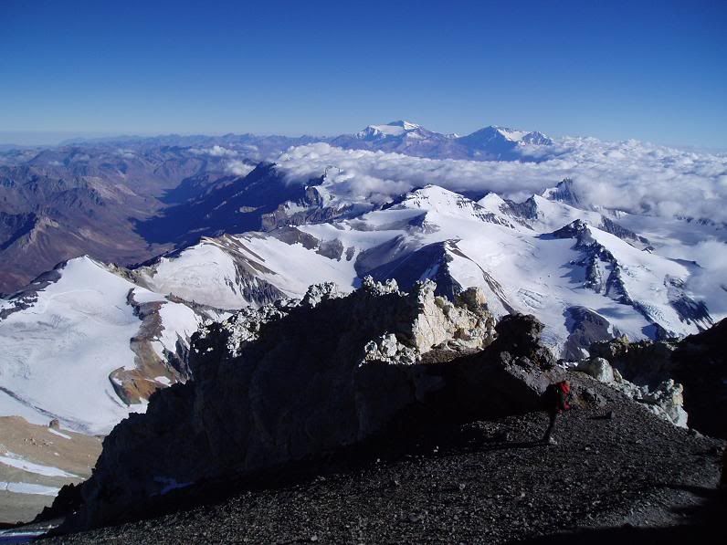
During the descent - above Piedras Blancas and Berlin
I descended much quicker than I had climbed, but still had to stop every few steps to wait for waves of nausea to pass by. It was with some relief that I actually started throwing up when I got to 5700m. After that I felt a little better – both physically and mentally, as I think my body confirmed that I had made the right decision to come down.
I got back to camp at 10.30am or so, just as Anabolico, the guide who had gone down with the 4 others earlier, was setting off to help another member of our group who had fallen ill up the mountain. The Guardaparques had been in radio contact with our group and his help had been requested – little did I realise this help was for me! He climbed up to Independencia quickly and spent a fruitless 2 hours looking for a sick person.
Back at Nido, after about 6 hours sleep I was feeling much better and was able to eat and drink a little. The first of our party came back at 6.30pm – only 15 hours after setting out. The remaining 6 had all summited together at about 1.30pm. The last of our party got back in at 7.30pm, literally on their last legs.
The next day we headed back down to Plaza de Mulas where there was a celebratory lunch arranged for us. We sorted out our gear – the next day we were to walk the 40km out to the park entrance at Horcones, and so we were to send almost everything back by mule to make the journey easier.
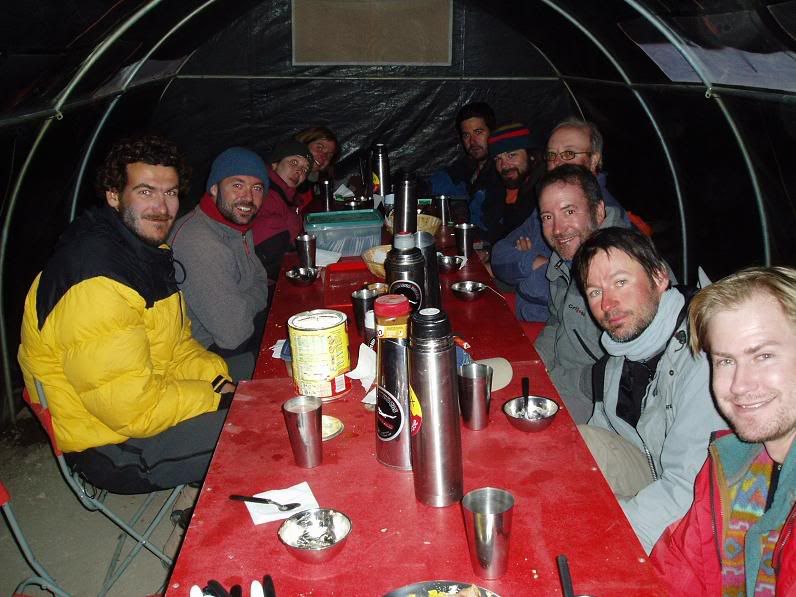
After the dinner, back in Plaza de Mulas
The walk-out day started very cold and windy, but almost as soon as we began our descent from Plaza de Mulas it warmed up. After the long days at altitude it became easier to breathe again and vegetation reappeared at about 3500m. In the Andes vegetation ceases about 1500m lower than in the Himalayas, and biologists suspect that the effect of altitude on the body in the Andes is physiologically comparable to being 1500m higher in the Himalayas.
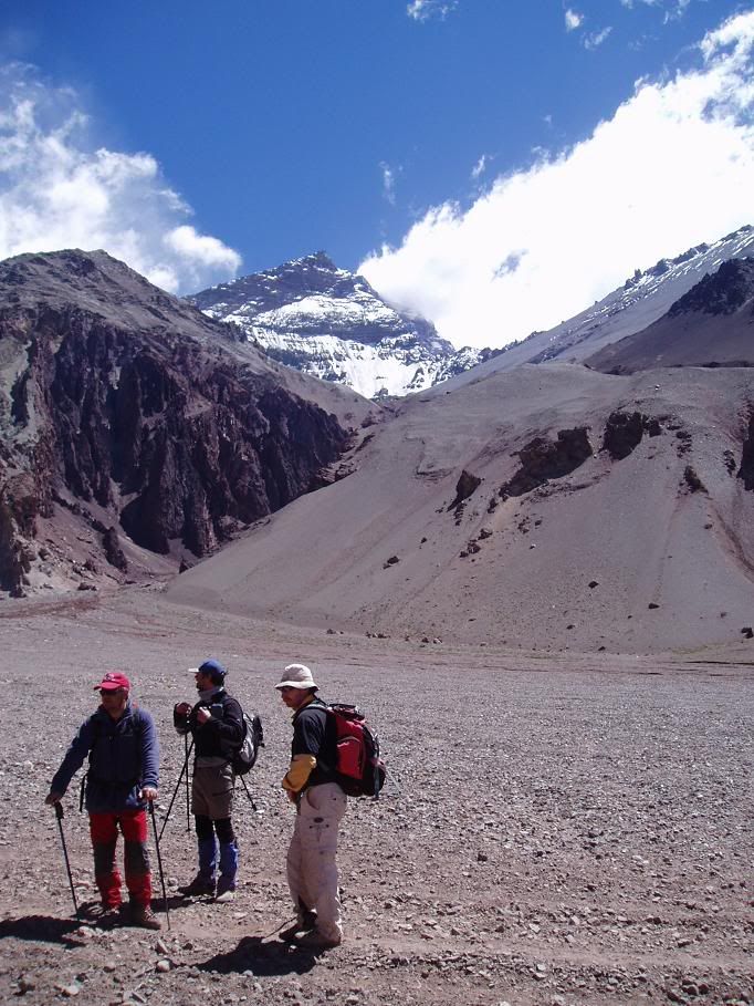
Back on Playa Ancha, Anconcagua in background
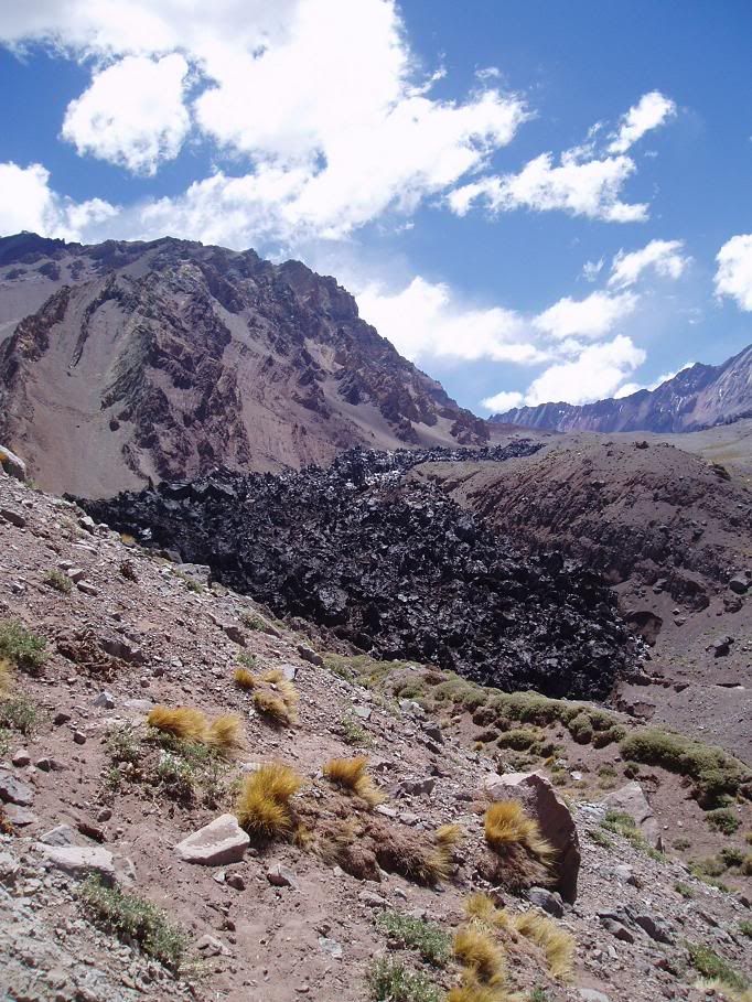
The end of the Inferior Horcones Glacier, a black tumbling mass of ice
We headed into La Confluencia briefly for lunch, greeted by the still crazy Matias, before covering the last 10km back to the park entrance in time for a transfer back to Mendoza.
As we walked out the park for the first time we could see all of the south face of Aconcagua, cloud free, rising 4km into the sky. It was as if she was saying her final farewell before we picked up our later transfer back to Mendoza.
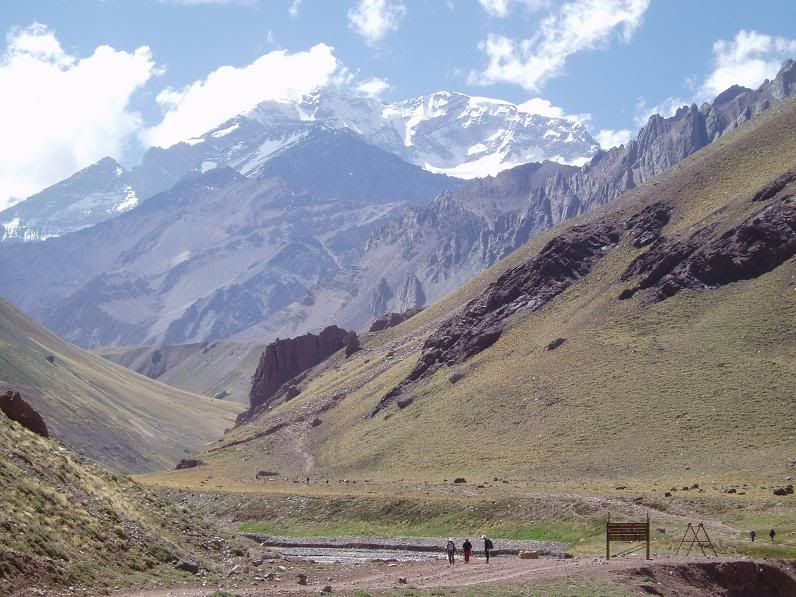
Aconcagua's farewell
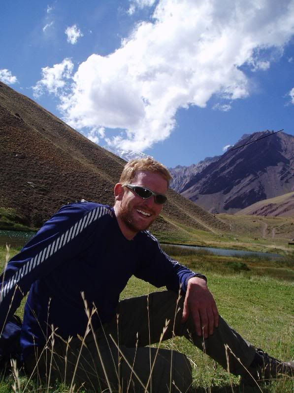
Finished at Horcones
And next? Well, I'm back in Mendoza enjoying some R&R. On Thursday I fly to Ushuaia in Tierra del Fuego, popularly know as the End of the Earth.
Tuesday, February 15, 2005
Aconcagua Part 2 - Base Camp Days
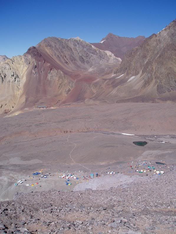
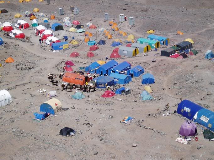
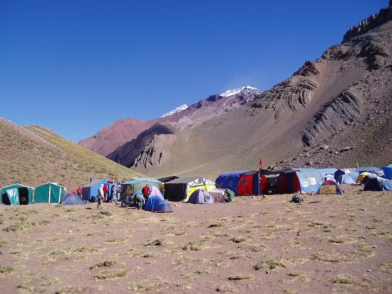
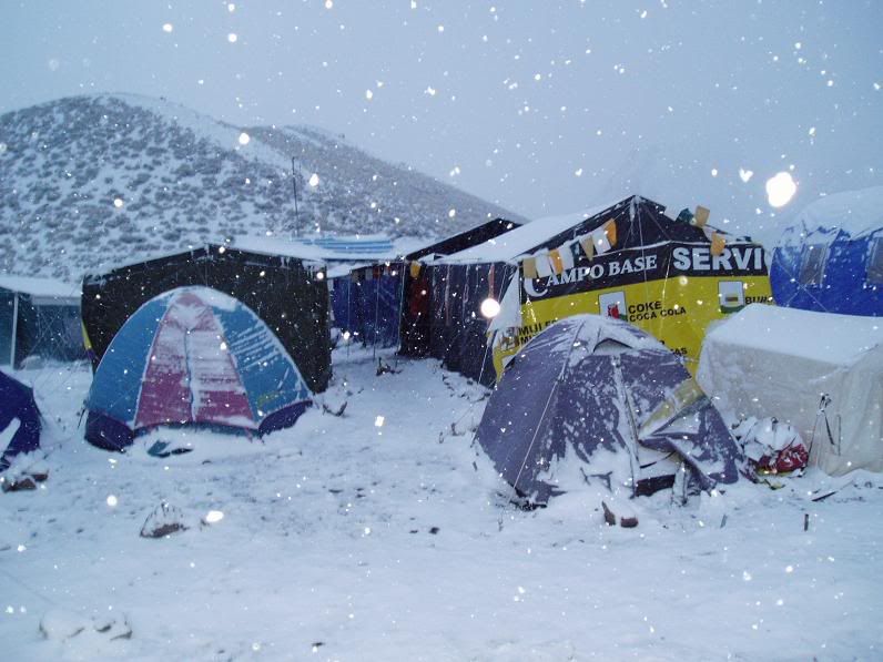
The rest day in Plaza de Mulas was an eye opener. The camp is, in reality, a small town of about 500 that caters for most things you could require. There's internet access ($5/min), porters (living in little tents), beds to rent (dorm tents), an "art gallery" (big tent), "pub" (bigger tent) and even a hotel (this one is a building). You can make calls on a sat phone for very reasonable amounts, order hot food and even take a hot shower ($5-10). The biggest problem at base camp is the lack of water and services. All base camp water comes from a glacier fed stream running down one side of camp - in morning it is beautifully clear, but by 11am the water has turned muddy brown due to meltwater runoff. This problem is compounded by lack of sanitation - I won't go into detail but the phrase "long drop" lets you know about the toilets. Part of the deal with trekking in the Park is that you have to pay to use the toilet services of one of the base camp companies. As I was on a fully paid up Campo Base trip then this was fine, but unscrupulous others failed to do this and hence the already questionable water supply was futher polluted.
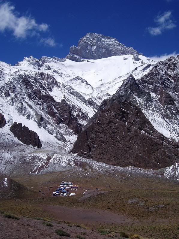
Plaza de Mulas with main base camp in foreground, hotel in distance and on horizon Cerro Bonete
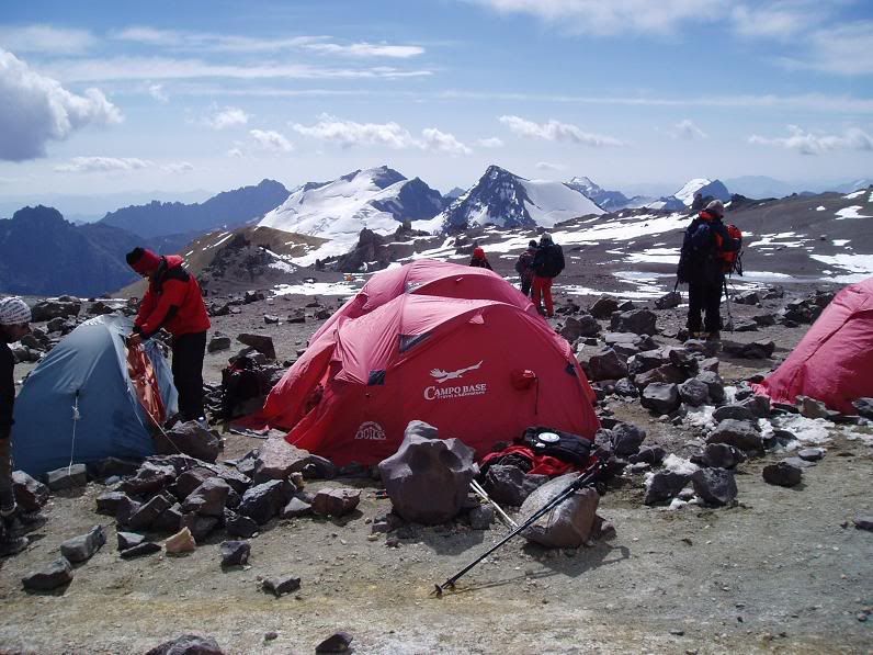
Campo Base base camp - several dorm tents, orange dining tent and octagonal cook tent
I visited the doctors in the morning - compulsory before you try to climb Aconcagua. They were very thorough, and were almost falling over themselves to dish out medication to anyone with the slightest sniffle. My back and neck were aching which I suspect was rucksack, rather than altitude, related. At altitude the body takes at least several days to adjust to the thin air, and there is a consequent increase in blood pressure, pulse rate and decrease in percentage oxygen saturation of the blood (SpO2). My vital statistics were - Pulse - 100, B.P. 140/90, SpO2 - 83%. Considering normal SpO2 is 98-99%, I was glad to be walking; my value however was about average in the group.
The other essential at altitude is to drink, drink and drink. You need to drink 4-5 litres of water a day to cope properly; when in the afternoon the "juice" that they serve is half full of sediment it gets pretty hard to inbibe your quota.
At 4260m the temperature rarely gets into double figures in the day.The sun is extremely strong and can burn within minutes due to a much thinner layer of atmosphere to protect from UV rays. So during the day, out of the cold wind, you can sit in long sleeved tops and trousers and feel fairly comfortable. The minute the sun sets, however, the temperature plunges below zero and everything begins to freeze.
Sunset over Cerro Cuerno, north of base camp
Here the stuff we had sent up from the hostel came in handy - down jackets, fleece trousers and all manner of expensive North Face items. The average night time temperature was probable -5 to -10 degrees, helped by an invariably cloudless night sky filled with southern constellations - an upside down Orion, the Southern Cross, and a couple of huge nebulae.
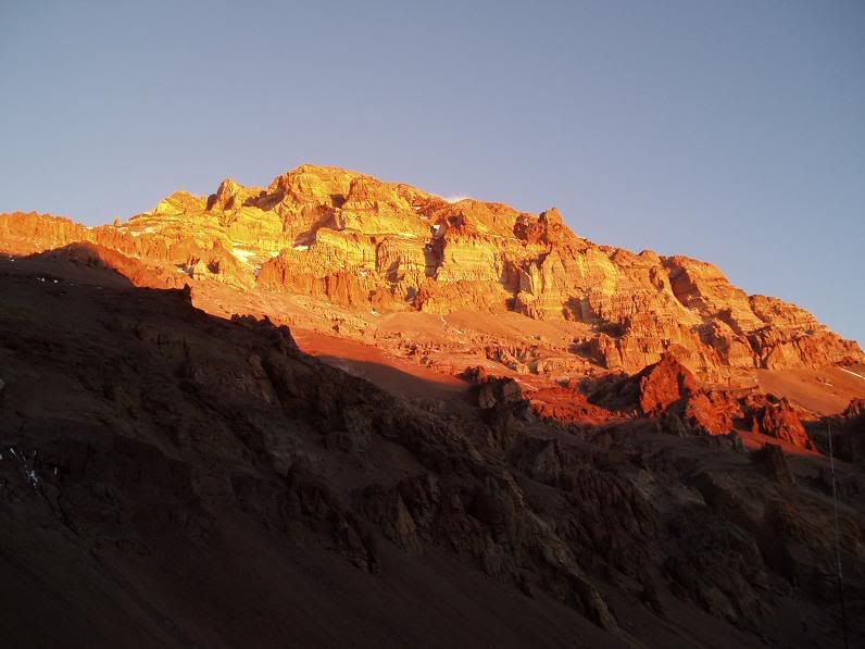
Sunset over the west face of Aconcagua
On the 3rd of February the plan was to walk up Cerro Bonete, a 4900m peak to the west of base camp that would help with acclimatision process. I woke with a splitting headache and feeling nauseous; after forcing down some breakfast and Ibuprofen I felt a lot better. Accompanying our group was our guide, Apu, plus Xavier, manager of the Campo Base staff who was very friendly and patient. On the way we went past the base camp hotel before starting the slow climb up to the top - a long slog of about 3 hours in total. From the top there were excellent views of the west face of Aconcagua that towers over Plazas de Mulas base camp, plus a range of views in every other direction. Unfortunately Paco couldn't make it to the top - he was having a harder time than the rest of us adjusting to the altitude. Altitude sickness is not something that you can predict will occur - it can happen to the fittest or the most unfit or people with equal regularity. Some bodies adjust quicker to the altitude, others don't seem able to.
West face of Aconcagua from the slopes of Cerro Bonete
Yours truly on top of Cerro Bonete; Aconcagua in background
The descent from the Cerro was great fun but an ecologist's nightmare. Lack of vegetation means most slopes are just scree runs that become terribly eroded as soon as any group of 14 pass by on them. On return to camp I shelled out $5 for a hot shower - my first in a week. It felt lovely, but I didn't get the chance to shave, so my baby beard continued to grow. I also changed my clothes for the first time - nice.
The 4th of February was another rest day, and another trip to the doctors. My SpO2 had increased to 84%, my B.P. was the same and my pulse was 91. I was improving. And I even washed some clothes - albeit in the mud-laden meltwater off the glacier.
The plan for the next day way a porterage up to Nido de Condores, the camp at 5200m which is the lowest height at whihch you can begin a summit attempt. It's almost 1km higher than Plaza de Mulas, although not far as the crow flies - basically a long slow slog up the lower slopes of Aconcagua. Most people carried with them further equipment they wouldn't use in base camp - crampons, extra gloves and hats, plastic walking boots and the like. We also had to carry some food and fuel for the stoves already up at Nido. I decided to test out my (hired) plastic boots - these basically consist of an inner thermally lined boot which then inserts into a rigid plastic shell - on a par with ski boots but a little more flexible. They become necessary at higher altitudes in extreme cold and when there is snow and ice to walk on in crampons.
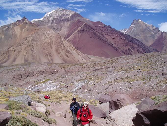
The group at Piedras Conway, on the way up to Nido
Xavier left early in the morning for Nido to carry a further load of food up, before descending again to accompany our group back up. He had to do this so that Apu, our guide, could run up to Berlin camp at 5900m and bring down tents we could put up. On the way up we passed Plaza Canada, an intermediate level camp at 4700m or so.
View up the hill from Plaza Canada, Xavier pointing out salient features of the mountain
We reached Cambio de Pendiente at lunch, about 5000m. I had another splitting headache and and was feeling sick again - probably altitude related. Paco was again unable to make it higher than Plaza Canada. The rest of us were feeling out of breath with each step, a feeling that got worse once we reached Nido and started putting up tents. My favourite part of the day was the descent - another erosion nightmare, but great if you like scree running (even if it is in plastic boots).
The camp at Nido de Condores
Dinner that evening was pretty good, despite the fact that Xavier had climbed the equivalent of 2km vertical height. I bumped into some other Brits on a Jagged Globe expedition - after 10 days of Spanish only it was a bit strange speaking in the mother tongue.
The 6th was a rest day, well earned after the exercise of yesterday. My main activity of the day was sleeping, punctuated by eating and a visit to the doctors - Pulse 85, B.P. 120/80, SpO2 87%. This exceeded the requisite 85% needed to attempt the summit, so all in all I was the picture of health! This has to be taken relatively - every night you get a blocked nose and congested sinuses, breath cold mountain air through your mouth that becomes rapidly dries followed by your tongue drying and cracking.
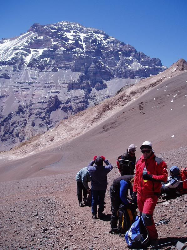
Originally the 7th was planned as the first day of the summit attempt, but several members of the group were a little under the weather so we had an extra rest day - my visit to the doctors (again) confirmed my good health and readiness for the summit. In the late morning four of us went for a quick 1 hour blast up to Piedras Conway, some 250m above Plaza de Mulas on the way to Nido.
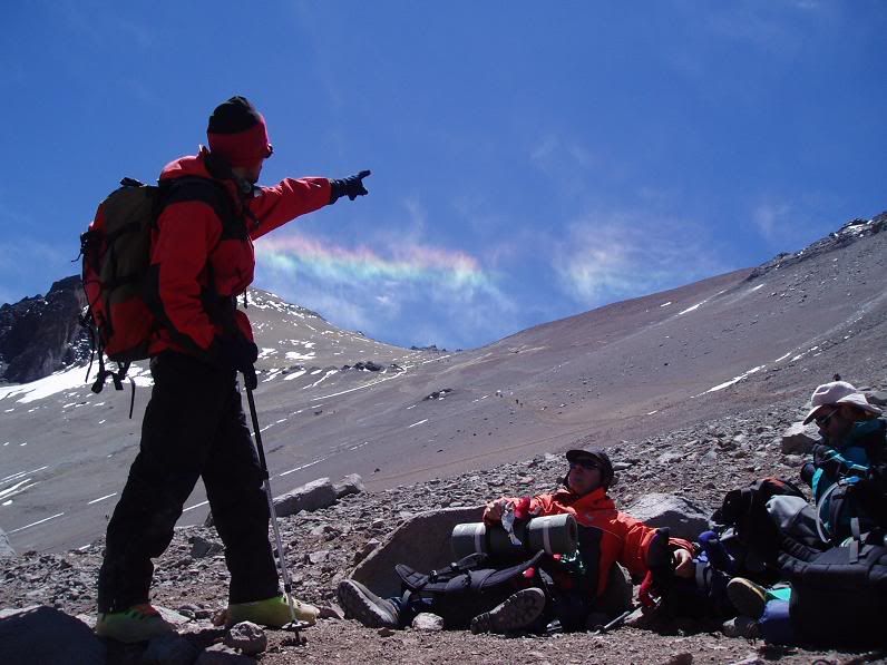
At Piedras Conway for the second time; Aconcagua in background
With a possible change in the weather on the way, the 8th way set as the day on which we hwould have to begin the summit attempt.
Aconcagua Part 1 – Journey to Base Camp
Thursday 27th of January was an earlier start than I had had for at least a week. I was met in the hostel by Apu, a young Peruvian who was to be our professional moutain guide for the trip. We took a taxi to an unexpectedly nice hotel where I met the rest of our group.
In total there were 12 of us; 3 middle aged Spanish blokes (Jose-Luis, Paco and Ramon), 3 younger Spanish guys (Daniel, Mercedes and Rafael), 2 Swedes (Henrik and Mats), one Italian (Davide) and myself. 2 more Argentinians (Matias and Veronica) were due to meet us the next night. The language of choice was Spanish – only one of the Swedes couldn't speak it.
The next morning we headed off early to get our Park Permits – a cool $300 for permission to climb Aconcagua. The cost did include free medical care at base camps and helicopter evacuation if needed, and it's a lot cheaper than the Everest permit ($10000!). After a bit of last minute emergency gear shopping, we left Mendoza for the Andes. Aconcagua lies about 40km to the north of the Trans-Andean Highway (which is also part of the Pan-American Highway), some 20km inside Argentina.
We stopped for the night in a hostel in Los Penitentes, an out of season ski resort. It was cool and a strong wind was blowing. The hostel had a warm atmosphere, helped by the wood cladding and cramped quarters. From here our warm and heavy high-altitude equipment that we needed for Aconcagua would be taken by mule to the base camp at Plaza de Mulas.
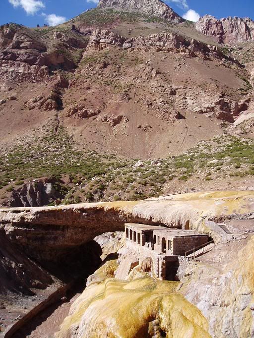
The following morning, equipped with basic trekking gear, we set off for Las Horcones, the entry point to Aconcagua Provincial Park. On the way we stopped at the incredible natural bridge at Puente del Inca, a famous Argentinian tourist spot. The bridge is the product of some volcanic processes too complicated for me to understand, but has lots of hot springs and has been developed in the past as such.
Puente del Inca
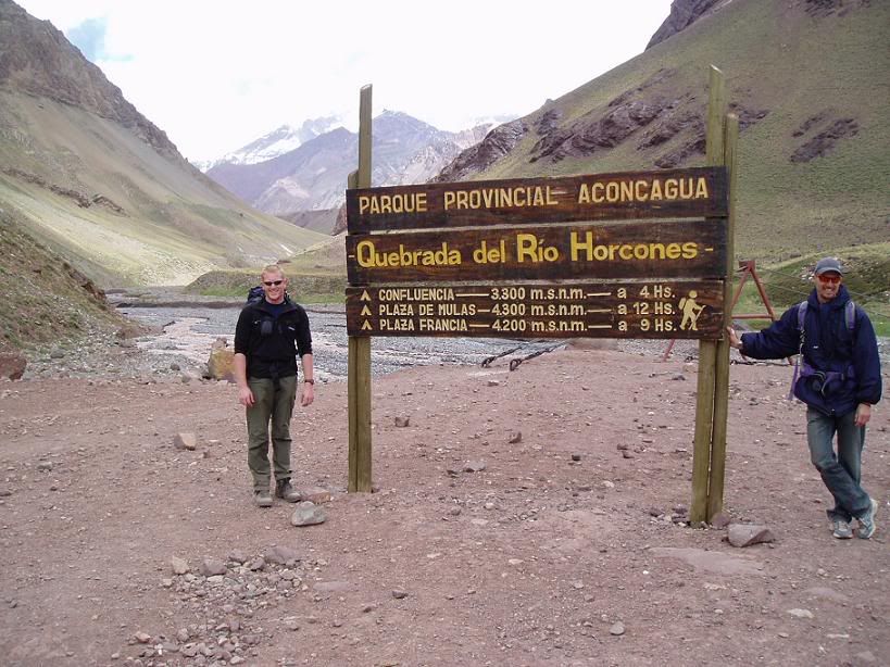
After the normal due process with the Guardaparques at the park entrance, we began the walk to La Confluencia, the camp a third of the way to base camp, where we would spend a couple of days acclimatising to the altitude (3300m at this point). We had our first views of the south face of Aconcagua, rising several kilometers into the sky to the north.
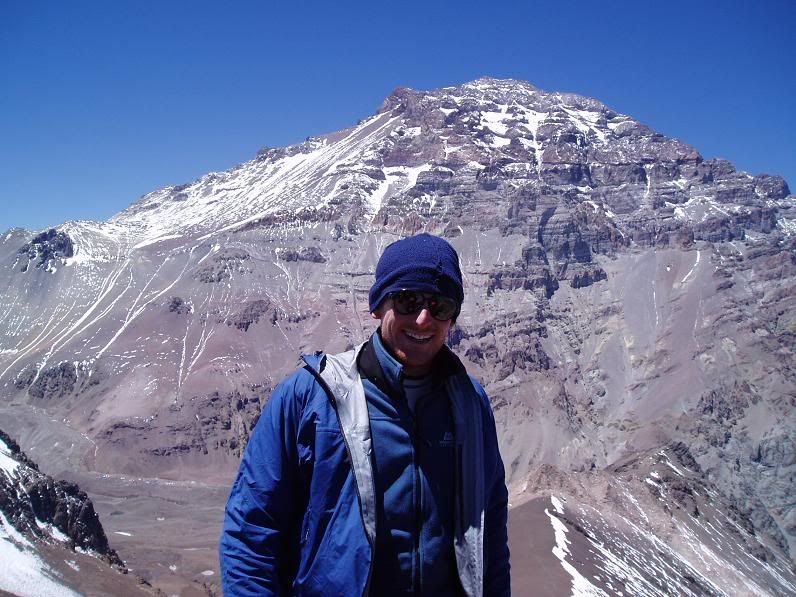
Entrance to Horcones Valley, with Aconcagua in background
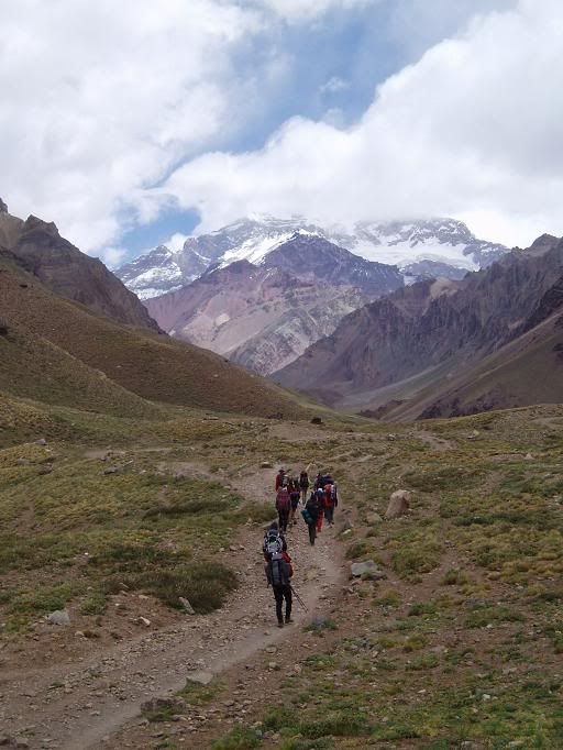
On the way to La Confluencia, with Aconcagua in background
We arrived at La Confluencia to be met by Matias, a half mad Argentinian who could cook pretty well and managed our part of the camp. When the sun went down it wasn't too cold, but I was glad when I crawled into my (hired) down sleeping bag that night.
La Confluencia in the sun; Aconcagua in far background
The next morning the plan was to walk up to Plaza Francia, the base camp for the south face, sitting at a height of 4200m. La Confluencia , as it's name suggests, lies at the confluence or two valleys – the Inferior and Superior Horcones Valleys, and the walk took us up the Inferior Valley, past the similarly named glacier.
Walking up to Plaza Francia
There were excellent views to start with, but after a few hours the sky clouded over and wind picked up. It became really cold and after reaching a good viewpoint we stopped and ate lunch, trying not to freeze. The south face was obscured by cloud and sadly 2 French climbers disappeared in the weather, never to be seen again.
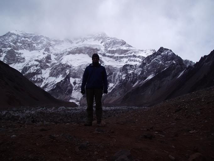
South face of Aconcagua, in the gathering storm
We headed back to Confluencia quickly, where a lot of the team had altitude related headaches. After some ibuprofen and a sleep I felt a lot better, but woke up to a world of white. Snow had been falling for 2 hours and showed no sign of abating. Having been assured by our guide Apu that we could probably wear shorts, most of us were pretty ill-equipped for the degree of cold (-5°C approx) and we passed a cold night as the snow continued to fall.
Snow falling at La Confluencia
Pepe (Jose-Luis), Daniel, Rafael and Mercedes in the snow
Then next day was planned as a rest day, which was fortunate as overnight everything in camp had frozen and there was no running water anywhere. By mid-morning the clouds had lifted and after lunch the sun had re-emerged. The snow melted quickly and the area returned to it's former glory quickly.
After the snow, at La Confluencia
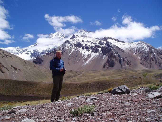
After the snow, near base camp (self timed!)
The following morning we set out early for Plaza de Mulas, main base camp for Aconcagua where we would spend a further 5 or so days acclimatising before trying for the summit.
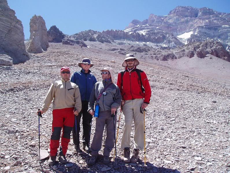
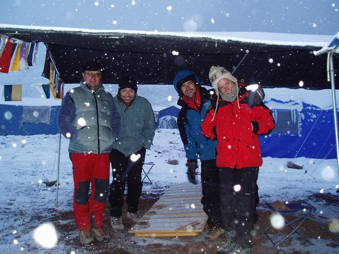
The team at base camp before leaving; from left to right – me, Matias (camp manager), Matias, Veronica, Ramon, Davide, Pepe, Paco, (another Italian who wasn't in our group), Mercedes, Rafael, Mats, Henrik (kneeling), Kim (also not in our group), and Daniel
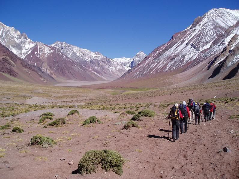
The 28km walk included a 15km stretch along Playa Ancha, literally “Wide Beach”, that seemed to go on forever, before we started the climb at the end of the day up to Plaza de Mulas at 4260m.
The beginning of Playa Ancha
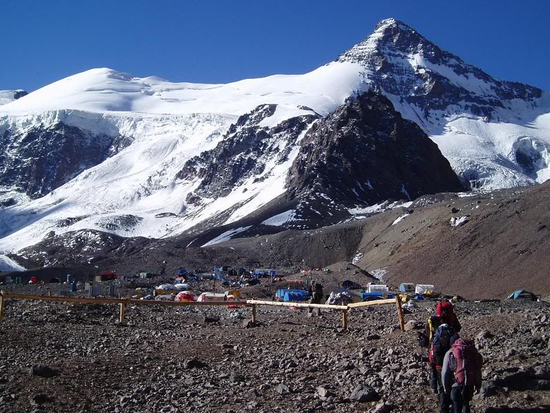
Arriving in Plaza de Mulas
We got to Plaza de Mulas at 7.30pm after a gruelling day. Most of us has headaches again and anything more than a slow walk required effort to breathe. After an excellent dinner we all crashed out in our 12 bed dorm tent, looking forward to a tomorrow, a rest day.
In total there were 12 of us; 3 middle aged Spanish blokes (Jose-Luis, Paco and Ramon), 3 younger Spanish guys (Daniel, Mercedes and Rafael), 2 Swedes (Henrik and Mats), one Italian (Davide) and myself. 2 more Argentinians (Matias and Veronica) were due to meet us the next night. The language of choice was Spanish – only one of the Swedes couldn't speak it.
The next morning we headed off early to get our Park Permits – a cool $300 for permission to climb Aconcagua. The cost did include free medical care at base camps and helicopter evacuation if needed, and it's a lot cheaper than the Everest permit ($10000!). After a bit of last minute emergency gear shopping, we left Mendoza for the Andes. Aconcagua lies about 40km to the north of the Trans-Andean Highway (which is also part of the Pan-American Highway), some 20km inside Argentina.
We stopped for the night in a hostel in Los Penitentes, an out of season ski resort. It was cool and a strong wind was blowing. The hostel had a warm atmosphere, helped by the wood cladding and cramped quarters. From here our warm and heavy high-altitude equipment that we needed for Aconcagua would be taken by mule to the base camp at Plaza de Mulas.
The following morning, equipped with basic trekking gear, we set off for Las Horcones, the entry point to Aconcagua Provincial Park. On the way we stopped at the incredible natural bridge at Puente del Inca, a famous Argentinian tourist spot. The bridge is the product of some volcanic processes too complicated for me to understand, but has lots of hot springs and has been developed in the past as such.
Puente del Inca
After the normal due process with the Guardaparques at the park entrance, we began the walk to La Confluencia, the camp a third of the way to base camp, where we would spend a couple of days acclimatising to the altitude (3300m at this point). We had our first views of the south face of Aconcagua, rising several kilometers into the sky to the north.
Entrance to Horcones Valley, with Aconcagua in background
On the way to La Confluencia, with Aconcagua in background
We arrived at La Confluencia to be met by Matias, a half mad Argentinian who could cook pretty well and managed our part of the camp. When the sun went down it wasn't too cold, but I was glad when I crawled into my (hired) down sleeping bag that night.
La Confluencia in the sun; Aconcagua in far background
The next morning the plan was to walk up to Plaza Francia, the base camp for the south face, sitting at a height of 4200m. La Confluencia , as it's name suggests, lies at the confluence or two valleys – the Inferior and Superior Horcones Valleys, and the walk took us up the Inferior Valley, past the similarly named glacier.
Walking up to Plaza Francia
There were excellent views to start with, but after a few hours the sky clouded over and wind picked up. It became really cold and after reaching a good viewpoint we stopped and ate lunch, trying not to freeze. The south face was obscured by cloud and sadly 2 French climbers disappeared in the weather, never to be seen again.
South face of Aconcagua, in the gathering storm
We headed back to Confluencia quickly, where a lot of the team had altitude related headaches. After some ibuprofen and a sleep I felt a lot better, but woke up to a world of white. Snow had been falling for 2 hours and showed no sign of abating. Having been assured by our guide Apu that we could probably wear shorts, most of us were pretty ill-equipped for the degree of cold (-5°C approx) and we passed a cold night as the snow continued to fall.
Snow falling at La Confluencia
Pepe (Jose-Luis), Daniel, Rafael and Mercedes in the snow
Then next day was planned as a rest day, which was fortunate as overnight everything in camp had frozen and there was no running water anywhere. By mid-morning the clouds had lifted and after lunch the sun had re-emerged. The snow melted quickly and the area returned to it's former glory quickly.
After the snow, at La Confluencia
After the snow, near base camp (self timed!)
The following morning we set out early for Plaza de Mulas, main base camp for Aconcagua where we would spend a further 5 or so days acclimatising before trying for the summit.
The team at base camp before leaving; from left to right – me, Matias (camp manager), Matias, Veronica, Ramon, Davide, Pepe, Paco, (another Italian who wasn't in our group), Mercedes, Rafael, Mats, Henrik (kneeling), Kim (also not in our group), and Daniel
The 28km walk included a 15km stretch along Playa Ancha, literally “Wide Beach”, that seemed to go on forever, before we started the climb at the end of the day up to Plaza de Mulas at 4260m.
The beginning of Playa Ancha
Arriving in Plaza de Mulas
We got to Plaza de Mulas at 7.30pm after a gruelling day. Most of us has headaches again and anything more than a slow walk required effort to breathe. After an excellent dinner we all crashed out in our 12 bed dorm tent, looking forward to a tomorrow, a rest day.
Subscribe to:
Posts (Atom)