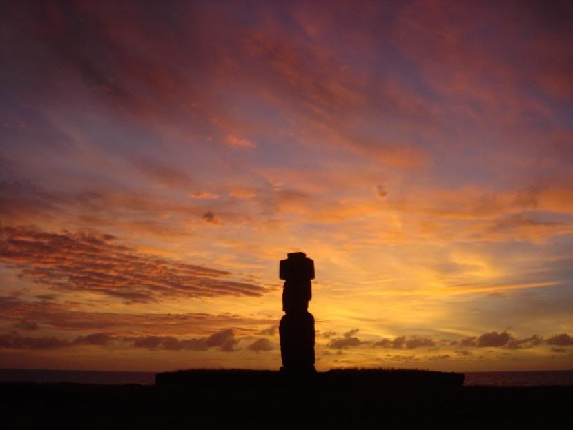
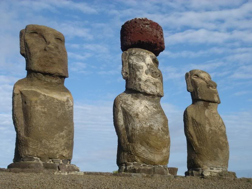
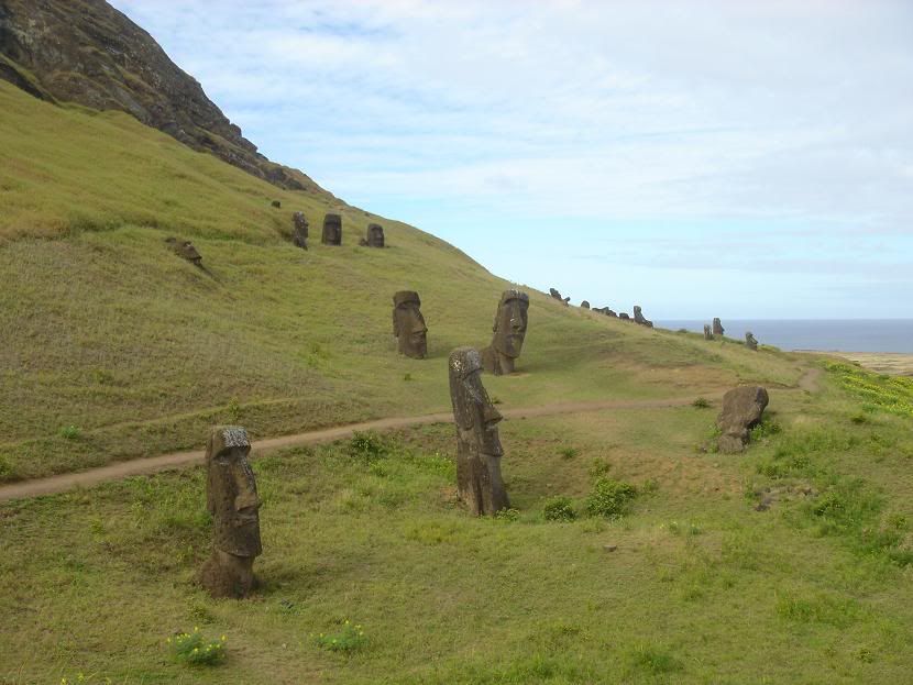
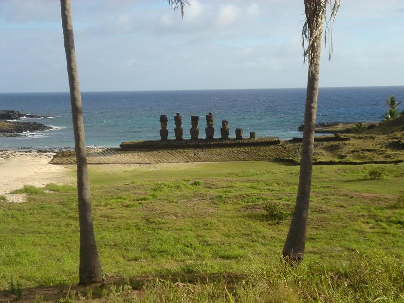
When I got back from Easter Island I resolved to shift up a gear and start travelling more quickly. The downside to this is that it is always harder to meet people when moving fast, and always being on the move tires you out in no time. My route was taking me north into Chile through the Atacama desert, before crossing back into Argentina and making my way to Buenos Aires - all in a few weeks.
The best option - for meeting people and covering ground quickly - proved to be taking a "flexible backpacker bus", that took 5 days to reach San Pedro de Atacama, in northern Chile, stopping at scenic locations en route and dropping us at the hostel of our choice each night. As things turned out, it didn't quite work like this, but the idea was a sound one.....
We left Santiago on the 7th May, 14 gringos in a small bus, heading for La Serena, a few hundred kilometres up the coast. There was the usual initial round of introductions ("Where are you from, how long have you been in South America, where are you going, do you speak Spanish...?") and soon our group - 4 English, 2 Irish, 2 Germans, 3 Swedes, 1 Canadian were all getting along well as we had our first lunch stop at at what was euphemistically called a "beach resort" en route to La Serena.
Our bus promised us stops for photos and walking in nice areas - but to be honest, doing this and covering several hundred kilometres a day isn't really practical. So we pulled into La Serena in the early evening, had a short stroll down the beach to an ugly lighthouse - the symbol of the town - before being dropped off at the accomodation picked for us.
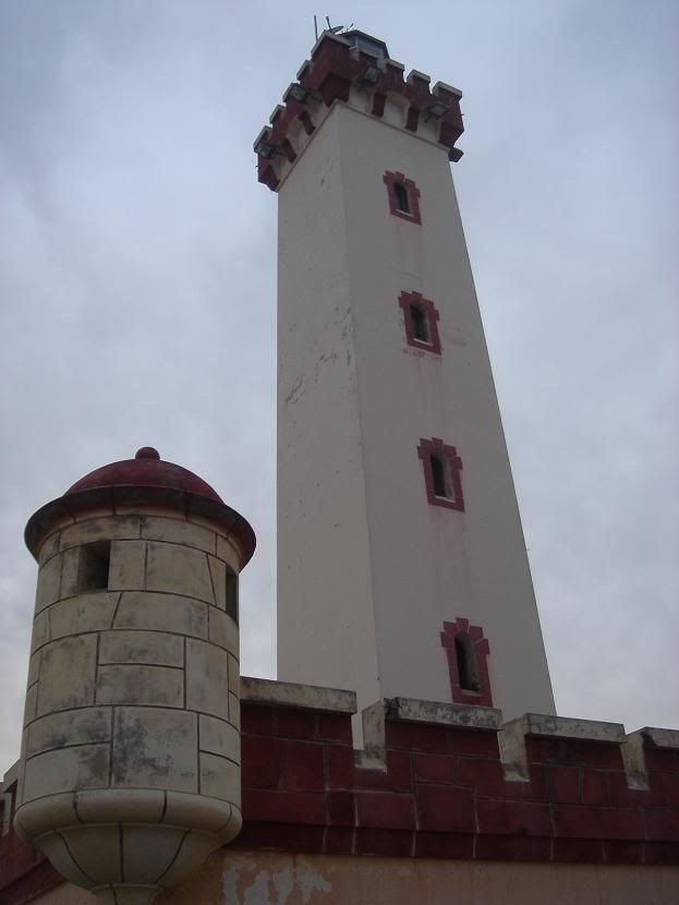
La Serena's lighthouse
The following day we headed further up the coast to Bahía Inglesa ("English Bay"), so named after an English pirate who settled in the area in the 1640s. Apart from the long white sandy beach there is little to be inspired about - the area is dry and pretty barren, and in the summer is burning hot. En route to Bahía Inglesa we stopped at Punta de Choros, a jumping off point for boat tours around a marine National Park. This was excellent - sea lions abounded, plus thousands of cormorants, pelicans and gulls. The beautiful islands made a very pleasant lunch stop, and the highlight was seeing a few handfuls of Humbolt penguins (too distant for photos!) - my fourth penguin species so far.
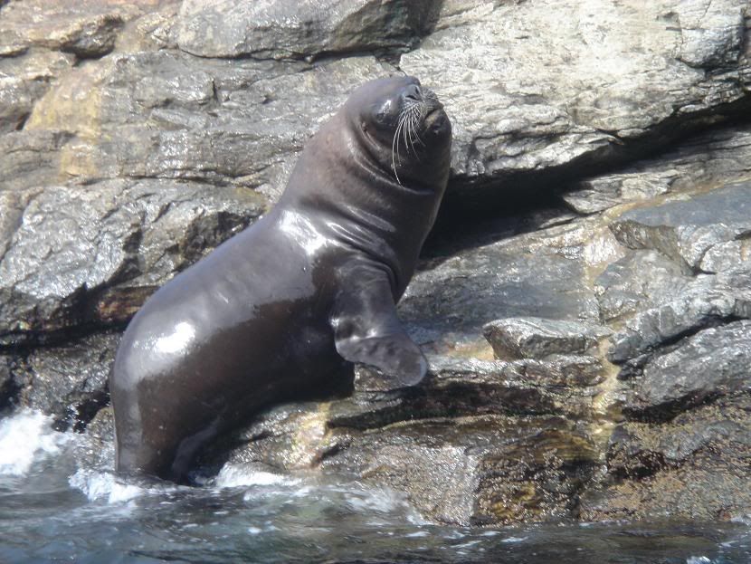
The Daddy of all sea lions
At Bahía Inglesa we stayed 2 nights to relax and enjoy the sea and a large barbeque. Of the 3 of us who made it into the icy sea, all of us escaped hypothermia, but resolved not to do it again until there was a tropical climate to enjoy when getting out. The barbeque was an excellent - usual quantities of meat are 1kg per person at these things - and the last person turned in, definitely worse for wear, at 5am - 3 hours before we had to leave.
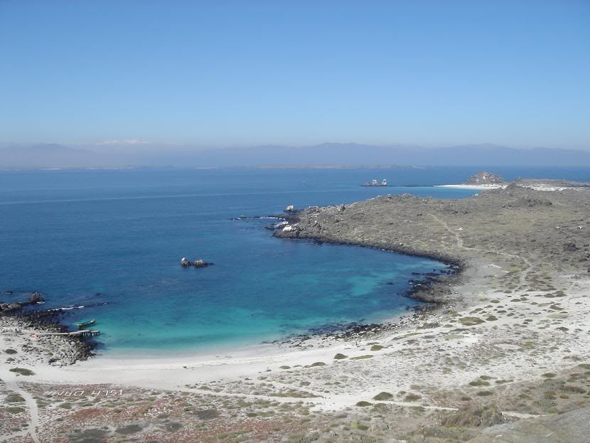
From the marine National Park
The longest day heading north was the following stretch to Antofagasta, passing through huge bare stretches of the Atacama desert where in some places no rain has fallen in the past 50 years. Antofagasta is a large city on the coast, existing for one reason - mining. The Atacama is rich in mineral resources and in the 1870s, when global demand for saltpetre was high, Chile annexed a large part of coastal Bolivia, thus precipitating the War of the Pacific against Peru and Bolivia. Bolivia came off the worst, losing all it's coastline to Chile, who built a railway line into the now landlocked country by way of compensation.
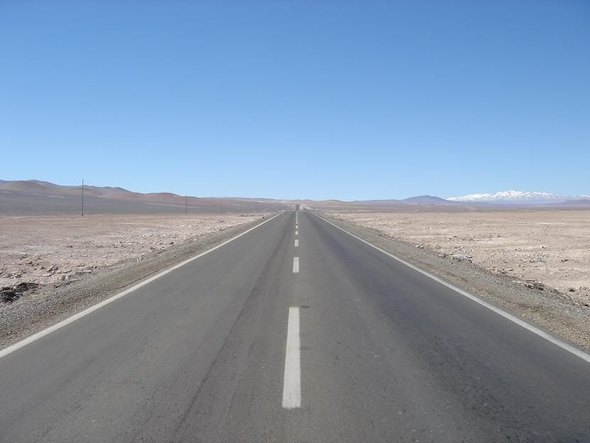
Pan-American Highway
En route to Antofagasta we stopped only three times in the parched desert heat. The first was a lunch and photo stop at a fuel station, where trucks thundered past on the Pan American Highway, on an unbending road to the shimmering horizon. The second was at a miners cemetery, where the windblown sand had eroded away coffins and left just bleached white bones . Finally we stopped at the "Hand of the Desert" - it left me wondering how much more there was under the magnificent scenery. We arrived just a little late for sunset in Antogfagasta, and ate in a pretty shocking pizzeria (sometimes you can have too much beef) - the "Hawaiian" pizza included glacé cherries as a topping. Odd.
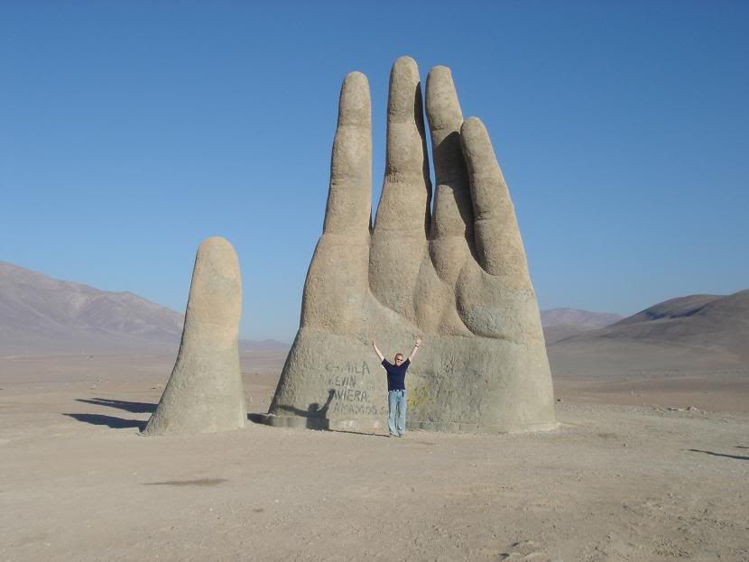
Erm.....
We turned west the next day and started crossing the Atacama to reach San Pedro de Atacama, a small oasis town that has become a major tourist centre in the region. A few hours west of Antofagasta we reached the salt flats that the area is famed for. The initial view was not as impressive as I had expected, but as we got to the flats the variety and size and thickness of the salt crystals was unlike anything I had ever seen. There was a lot of salt production in the area and in places there were mountains of refined salt that glowed white amongst the surrounding dirty brown flats. We arrived at an oasis for lunch - a former important stop on the Inca Royal Road that stretched all the way up the Andes to the Incan capital in Cusco, Peru. Despite the sun, swimming at 2500m was a cold and slightly smelly (lots of algae) experience - but there was something special about being in the water, overlooking the desert with snowcapped Andean peaks behind you.
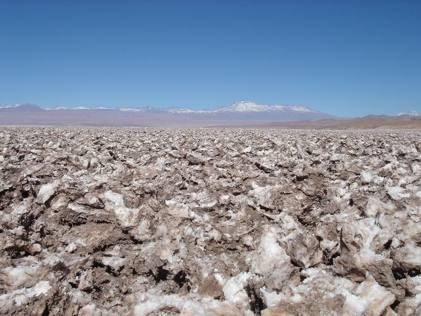
Salt Flats
We stopped at the Salar de Toconao for sunset. This salt flat is a small one in comparison to the huge Salar de Uyuni in Bolivia, but as a taster it was great. Underneath the salt there is still a lagoon, and in places there is water on the surface, where flamingos love to feed. The sight was spectacular as the sun set over the Salar and against the chain of volcanoes that make up the Andes cordillera at this point. With the sun out of the sky the temperature plummeted and we made the short drive into San Pedro in the cold dark.
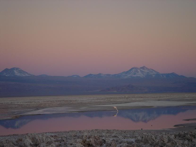
Sunset of the salt flats...
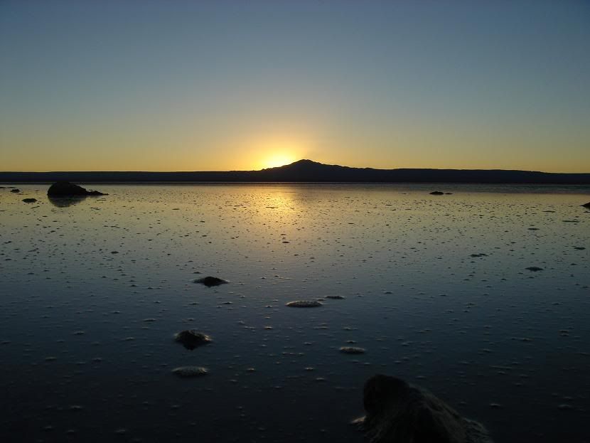
...and the temperature falls.
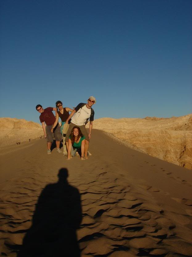
The following day our small group split up - most were staying for a couple of days in San Pedro and many were going to the Valley of the Moon to see sunset that evening. We spent the day wandering the adobe streets of San Pedro, drinking in the relaxed atmosphere after too long spent in buses. That evening we made the short drive to the most popular tourist spot around the town, the Valley of the Moon - so named becasue of it's stark lunar landscape. We watched the sunset accompanied by dozens of other tourists who had made the long trudge up a huge sand dune - it was nice, but given the plentiful surrounding terrain I couldn't help but feel there must be other things to do at sunset.
Almost all of our group wanted to go sandboarding the following day, and we had the good fortune to pick Javier, an Argentine sandboarder-cum-chef who transported us to the dunes and gave us some instruction, all at a good price. Being a sometime snowboarder, the instant sucess I expected was not forthcoming; the technique is different and the board needs waxing with each descent - which is good as after walking up the dune you need a rest. All the group had an excellent time, and 4 of us resolved to do it again the following day.
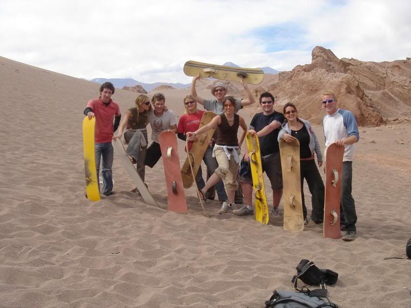
International Sandboarding Champions
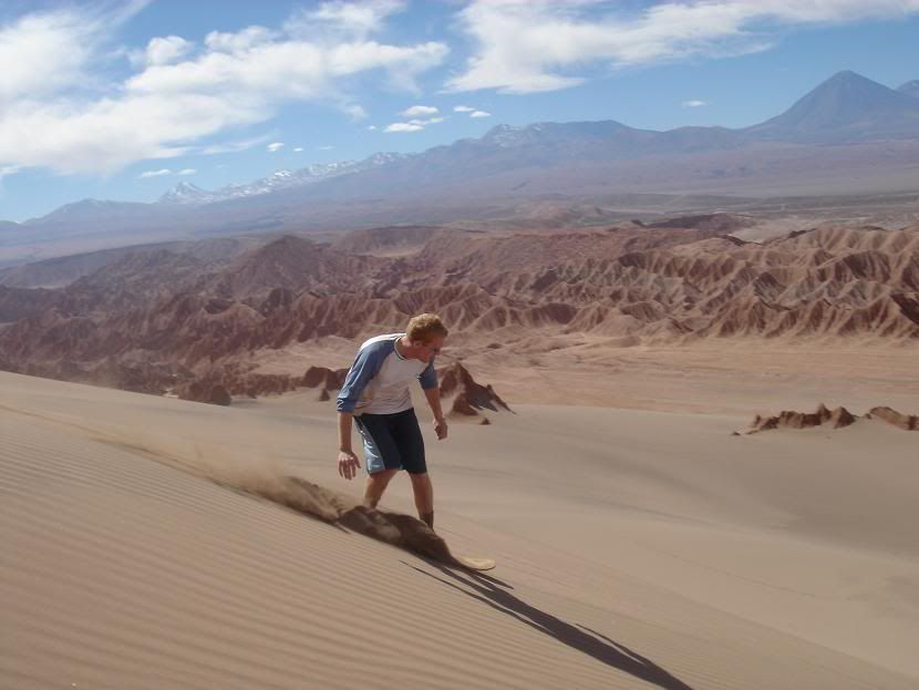
The second day of boarding was even better - after the previous day's small dunes Javier took us to a series of much larger dunes. The sand was firmer, we went faster and fell harder, and against the Andes backdrop it was truly stunning. After 5 hours and some very steep dune climbing we were ready to drop, and made the last run down a huge dune before the walk back across the hot desert sand to the jeep.
By the following day we were almost all out of cash (this major tourist town having no cash machine), and the four of us that were left - myself, Frank (a German doctor working in Mendoza), John and Lucy (an English couple of a year RTW trip) took the slow bus to Salta, in northern Argentina. The crossing reached 5000m - heights that I had been struggling at in February - before dropping down to the Argentine salt flats. As dark fell we were still driving south, missing rugged mountain scenery before arriving in Salta at midnight. We chose the cheapest hostel (bad idea) before eating some excellent food and turning in. Salta has a reputation on the Gringo Trail for being a very relaxed and fun party town. After changing hostels we set out to explore this, and found a relatively poor city with that couldn't match Mendoza for charm. We decided to hire a car the following day before stuffing ourselves with Argentina's best product - beef. For 2 quid I ate a huge (500gr or so) steak that was delicious.
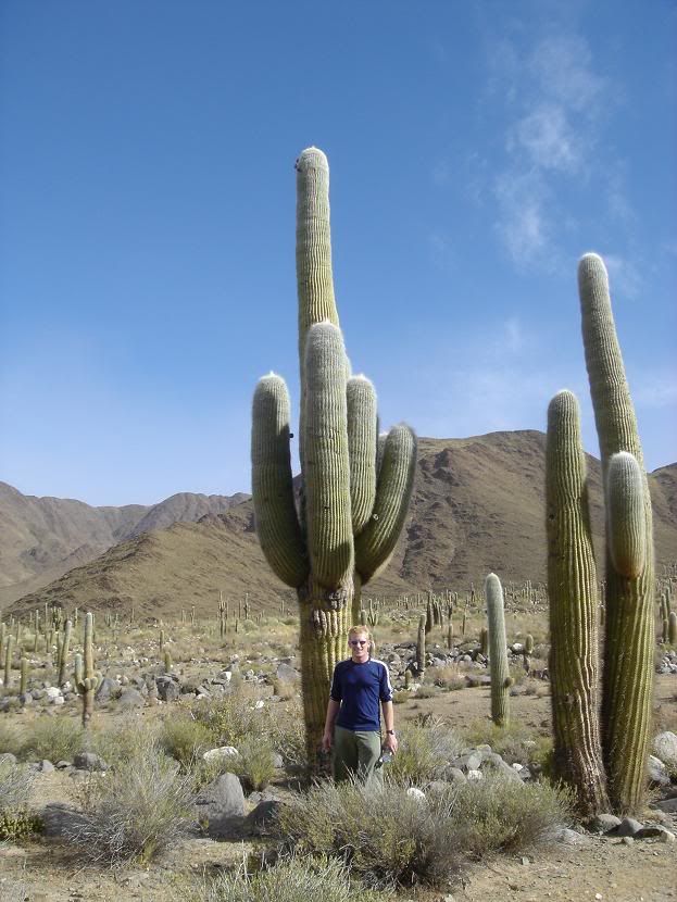
Giant cacti forests
The following day we drove to the small town of Cachi, some 170km southwest of Salta. The drive was worth as much as the town - passing first through a deep river canyon then ascending through forests of giant cacti up to Cachi. The town was reminiscent of San Pedro - sleepy, adobe buildings with stray dogs lazing in the sun. There were quite a few tourists around - not what we had expected - but it was incredibly easy to get off the beaten path; one question in a shop found us in a local restaurant, not 20m from the main square, unvisited by other tourists.
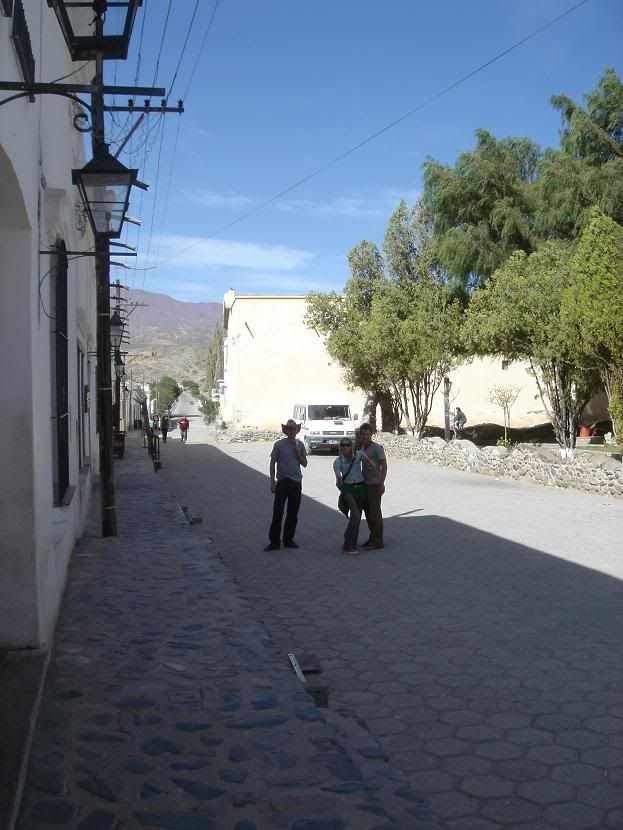
In Cachi - Frank, Lucy and John
We headed out to some pre-Incan ruins at Las Pailas afterwards; the ruins are huge and barely excavated. Without a guide all we could see where some possible stone circles and tumbledown walls - all surrounded by the giant cacti.
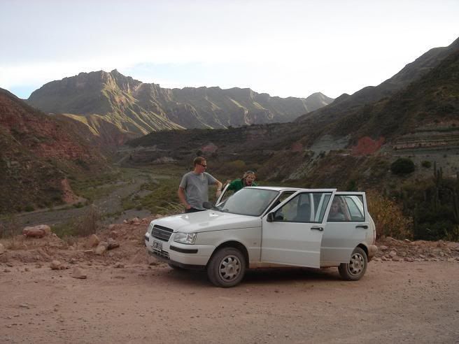
Driving back through the canyon
The following day I left for Mendoza with Frank on an 19 hour southwards bus ride, leaving John and Lucy to continue their route northwards into Bolivia. In Mendoza I was going to meet Wouter, a Dutch writer who I had met months before in Antarctica Hostel, Ushuaia. It seems a little frivolous to go some 12 hours out of my way just for lunch, but I reasoned that if I had the time.... It was well worth it - being back in Mendoza was like comfortable and homely, even if it was much colder than February, and lunch with Wouter was excellent. Frank, my erstwhile local guide, gave me free accomodation in his apartment and an insider's guide to a night out on the town. I left for Cordoba the following evening well pleased with my little detour.
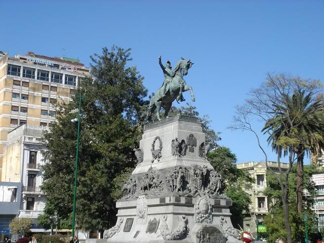
Cordoba central square - General San Martín
Cordoba, Argentina's second city of 4 million people, sits some 600km west of Buenos Aires at the heart of the argicultural region of the country. I arrived early in the morning, having enjoyed another overnight bus with coche-cama, an extra wide seat that reclines far enough back to allow a good sleep. I explored the heart of Cordoba during the day - it struck me as a larger version of Mendoza. At the hostel we arranged a night out - famed in this country because of it's huge student population - and sloped back in at 6am, earing ringing from the universal appeal of hip-hop and dance music. There is nothing quite as wasteful, both in terms of money and time, as Argentinian nights out. The night starts at around 2.30am, finishes at 7am, and the following day is a write-off. And although the prices are relatively cheap, your money tends to go a lot less further than when sober! So after an excellent lunchtime parilla at the hostel the following day, I went for another wander around the city before catching another late overnight bus to Buenos Aires.
Buenos Aires, Argentina's huge and bustling capital, never seems to stop. It's pretty traveller friendly and I made my way to the hostel in the subway before taking it back to the city centre to see the main sights. The financial crisis that crippled Argentina in 2000 is still an issue, and there is a huge, mostly unseen, poverty problem.There are regular street protests and the banks come in for particular amounts of stick. In the centre, where all the main bank offices are, the majority are boarded up with wood or metal screens covered in fly-posted protests; the few brave companies that have normal windows have them spraypainted on a daily basis by protesters. The anger is not limited to the banks - the central government office, the Casa Rosada, has security barriers ready to be erected at a moment's notice. The busy centre feels like any other city until you see the state of virtual siege of some buildings.
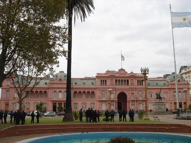
The Casa Rosada security force......
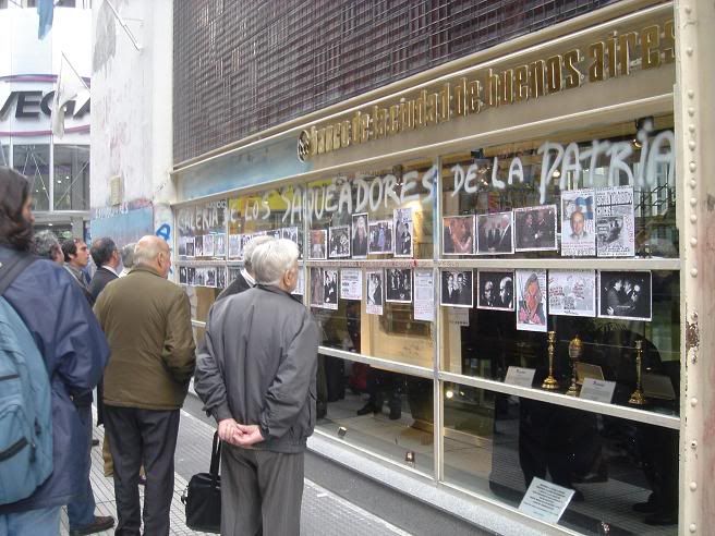
And banking the Argentinian way
The central square is named Plaza 25 de Mayo, the date in 1810 that Argentina gained independence from Spain under the auspices of General San Martin, leader of the Argentine army at the time and all-round South American hero. After his exploits in Argentina, he led his army over the Andes to assist Chile in it's fight for independence. Nowadays the Plaza is remembered for an entirely different reason - every Thursday the Mothers of the Disappeared parade around the square, in memory of those people still missing from the "Dirty War" conducted by the military dictatorship in the 70s and early 80s.
The heart of the city may be around the central square, but there are large separate districts t be explored. Recoleta, upmarket with parks and a famous cemetery (the resting place of Evita Peron), adjoins Palermo, with it's beautiful old buildings and narrow streets. Santelmo - home of my hostel - is a friendly, arty district, adjoining La Boca, a much poorer area and home to the Boca Juniors, Diego Maradona's old club. Today is the 25th of May, and apart from a lot of taxis with flags and no open shops, it seems to be business as usual. The Buenos Aires vibe - fun, relaxed and friendly - remains, and people are gearing up for a long weekend of partying due to the national bank strike called for Thursday and Friday. I might go to Uruguay.